")
")
Fig. 2
Download original image
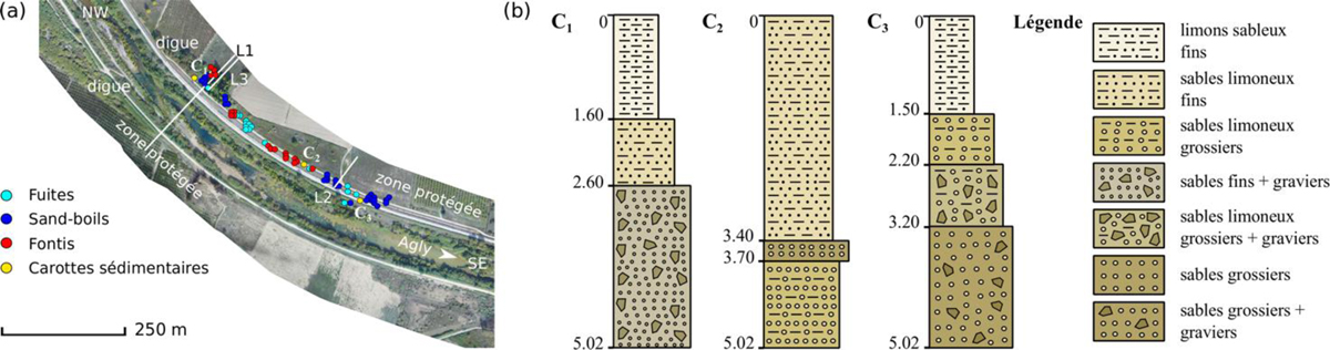
(a) Présentation de la zone d’étude où les signatures d’érosion (fuites, sand-boils et fontis) ont été localisées en rive gauche ainsi que les profils ERT exposés dans cette étude ; (b) Exemples de prélèvements de sols échantillonnés par carottage dans la zone d’intérêt, indiquant la présence de matériaux grossiers dans les couches perméables.
(a) Presentation of the study area where erosion signatures (leaks, sandboils and sinkholes) are located on the left bank, as well as ERT profiles exposed in this paper. (b) Examples of borehole logs, sampled in the study-area, indicating the presence of coarse materials constituting the permeable layers.
Current usage metrics show cumulative count of Article Views (full-text article views including HTML views, PDF and ePub downloads, according to the available data) and Abstracts Views on Vision4Press platform.
Data correspond to usage on the plateform after 2015. The current usage metrics is available 48-96 hours after online publication and is updated daily on week days.
Initial download of the metrics may take a while.