")
")
Fig. 2
Download original image
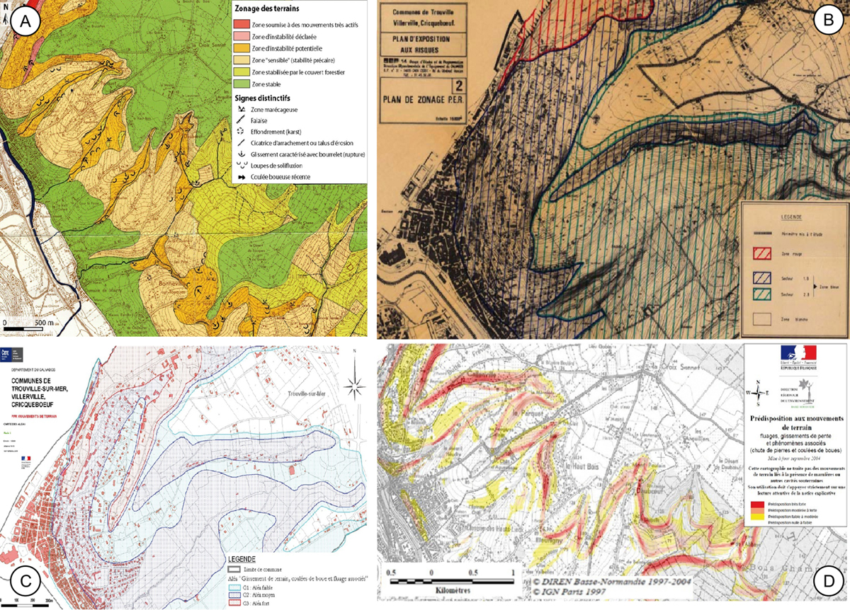
Extraits de cartes d’aléa réglementaires produites pour différents zonages réglementaires. A. Extrait de carte d’aléa ZERMOS pour Trouville/Pont l’Evêque (BRGM, 1976). B. Extrait du plan d’exposition aux risques (PER) Trouville/Villerville-Criqueboeuf (LCPC, Rouen, 1986). C. Extrait de la carte d’aléa au 1 : 10 000ème du PPR de Trouville/Villerville-Cricquebeuf (DDTM, validation le 24 avril 2009). D. Extrait de la carte de susceptibilité à différents glissements de terrain, carte produite par combinaison lithologie/pente (DREAL, 2004).
Extracts of regulatory hazard maps produced for different regulatory zoning. A. Extract of ZERMOS hazard map for Trouville/Pont l’Evêque (BRGM, 1976). B. Extract of exposed risk map (PER) for Trouville/Villerville-Criqueboeuf (LCPC, Rouen, 1986). C. Extract from the hazard map at 1:10 000 of the Trouville/Villerville-Cricquebeuf based on PPR procedure (DDTM, validated on 24 April 2009). D. Extract from the landslide susceptibility map produced by combination of lithology and slope (DREAL, 2004).
Current usage metrics show cumulative count of Article Views (full-text article views including HTML views, PDF and ePub downloads, according to the available data) and Abstracts Views on Vision4Press platform.
Data correspond to usage on the plateform after 2015. The current usage metrics is available 48-96 hours after online publication and is updated daily on week days.
Initial download of the metrics may take a while.