")
")
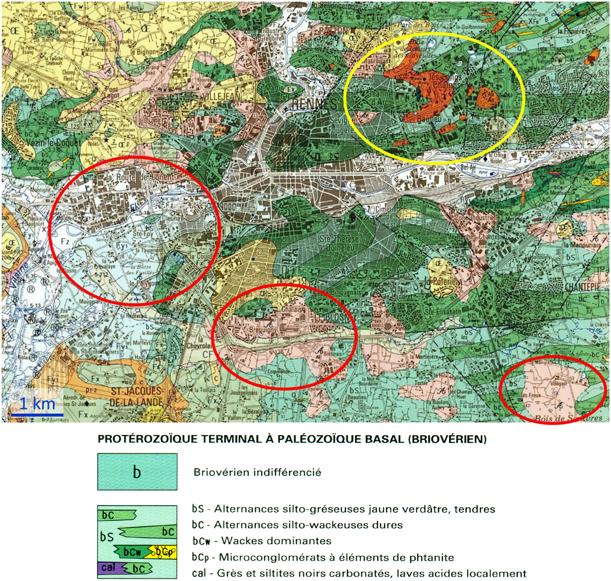
Fig. 2
Download original image
Carte géologique de l’agglomération rennaise (extrait de la carte imprimée au 1/50 000, disponible sur https://infoterre.brgm.fr/) échelle donnée par la barre 1 km. Les intrusions magmatiques sont cerclées de jaune, tandis que les cercles rouges indiquent les formations superficielles.
Geological map of the Rennes conurbation (extract from the 1/50 000 printed map, available on https://infoterre.brgm.fr/) scale given by the 1 km bar. Magmatic intrusions are circled in yellow, while red circles indicate superficial geology.
Current usage metrics show cumulative count of Article Views (full-text article views including HTML views, PDF and ePub downloads, according to the available data) and Abstracts Views on Vision4Press platform.
Data correspond to usage on the plateform after 2015. The current usage metrics is available 48-96 hours after online publication and is updated daily on week days.
Initial download of the metrics may take a while.